The best Garmin GPSMAP satellite communicator GPS unit for most people in 2026 is the GPSMAP 67i, while the GPSMAP 66i is the better value if you find it at a substantial discount and the GPSMAP 86i makes the most sense for boaters who need marine navigation.
Our top picks
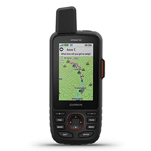 Garmin GPSMAP 66i
- Large 3” Sunlight-readable color display for easy viewing
- Trigger an interactive SOS to the geos 24/7…
- Preloaded Garmin TOPO mapping with direct-to-device Birdseye satellite…
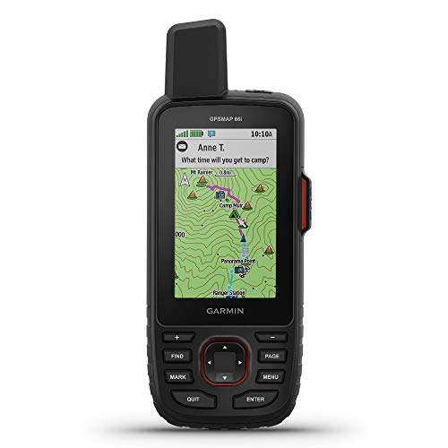 Garmin GPSMAP 66i
- Large 3 inch Sunlight-readable color display for easy…
- Trigger an interactive SOS to the geos 24/7…
- Preloaded Garmin TOPO mapping with direct-to-device Birdseye satellite…
 Garmin GPSMAP 67i Rugged GPS Handheld with
- Large 3” sunlight-readable color display for easy viewing
- Enable two-way messaging and location tracking via the…
- Access preloaded TopoActive mapping from Garmin, view satellite…
| Product | Key specs | |
|---|---|---|
| Garmin GPSMAP 66i | Large 3” Sunlight-readable color display for easy viewing Trigger an interactive SOS to the geos 24/7… Preloaded Garmin TOPO mapping with direct-to-device Birdseye satellite… | Check price |
| Garmin GPSMAP 66i | Large 3 inch Sunlight-readable color display for easy… Trigger an interactive SOS to the geos 24/7… Preloaded Garmin TOPO mapping with direct-to-device Birdseye satellite… | Check price |
| Garmin GPSMAP 67i Rugged GPS Handheld with | Large 3” sunlight-readable color display for easy viewing Enable two-way messaging and location tracking via the… Access preloaded TopoActive mapping from Garmin, view satellite… | Check price |
 Garmin GPSMAP H1i Plus Rugged Hiking Premium | Bundle Includes: Garmin GPSMAP H1i Plus, Premium GPS… Hybrid Design with Touch and Buttons: The GPSMAP… Stay Connected Beyond Cell Service: With inReach Plus… | Check price |
As an Amazon Associate we earn from qualifying purchases at no extra cost to you.
Quick verdict: which GPSMAP inReach unit should you buy?
| Situation | Best choice | Why |
|---|---|---|
| Long hikes, remote travel, and maximum battery life | Garmin GPSMAP 67i | Up to 165 hours of tracking battery life and modern inReach messaging |
| Lower-cost entry to GPSMAP satellite messaging | Garmin GPSMAP 66i | Similar core communication features, often available for less on the used or clearance market |
| Boating, coastal travel, and marine chart use | Garmin GPSMAP 86i | Marine-focused mapping, floating design, and wireless integration with compatible onboard electronics |
| Navigation without satellite messaging | Garmin GPSMAP 67 | Excellent battery life and navigation, but no inReach messages or SOS |
Garmin GPSMAP 67i: the best all-around satellite communicator
The GPSMAP 67i is the strongest choice for most hikers, hunters, overlanders, and expedition travelers. It combines a conventional handheld GPS with Garmin’s inReach satellite network, so it can send and receive text messages, share location, provide weather information, and trigger an SOS when cellular service is unavailable.
Its main advantage is endurance. Garmin rates the GPSMAP 67i for up to 165 hours in tracking mode, or up to 425 hours in expedition mode under suitable conditions. Actual runtime falls when the screen is bright, tracking intervals are short, Bluetooth is active, or the device is frequently transmitting messages.
The 2.6-inch color display has a 160-by-240-pixel resolution. It is not a smartphone-sized map, but the transflective screen remains readable outdoors and uses less power than a large touchscreen. Physical buttons are useful in rain, cold weather, and while wearing gloves.
The 67i includes multi-band GNSS support and can use multiple satellite systems, improving positioning in difficult terrain, forests, and urban canyons. Its built-in topographic mapping is useful, although serious navigators may still want more detailed regional maps or compatible Garmin map products.
What the GPSMAP 67i does best
- Provides the longest battery life of the main handheld GPSMAP inReach options.
- Supports two-way messaging through the Iridium satellite network, which is designed for global coverage outside the polar extremes.
- Includes interactive SOS communication rather than a one-way distress beacon.
- Uses buttons instead of relying on a touchscreen.
- Offers a rugged, IPX7-rated body and a built-in rechargeable lithium-ion battery.
GPSMAP 66i: still useful, but harder to justify at full price
The GPSMAP 66i remains a capable satellite communicator, particularly when discounted. It has the same basic inReach concept: global Iridium messaging, location sharing, weather reports, tracking, and 24/7 SOS coordination through Garmin’s emergency response service.
Compared with the 67i, the 66i is an older design with shorter battery endurance. Garmin rates it for approximately 35 hours in standard tracking mode and up to 200 hours in expedition mode, depending on settings and satellite conditions. It is still adequate for weekend trips, but the difference becomes important on multi-day routes where charging opportunities are limited.
The 66i has a 2.6-inch color display and physical controls, plus a 16 GB internal memory capacity for maps and data. It is a sensible purchase when its market price is clearly below the 67i. If the price gap is small, the newer 67i generally offers better long-term value because of its battery improvements and newer positioning hardware.
Who should choose the 66i?
- Occasional users who want a lower initial purchase cost.
- Travelers whose trips usually last one to three days.
- Owners who already have compatible Garmin accessories or map data.
- Buyers comfortable with an older device and potentially shorter remaining battery life.
GPSMAP 86i: the marine specialist
The GPSMAP 86i is the right pick when satellite communication is only part of the job. It adds marine-oriented features to the GPSMAP handheld format, including compatibility with selected Garmin chartplotters and onboard systems. It also floats, which is a practical safeguard on a boat even though it should not replace a tether.
It weighs about 272 grams and has a 2.6-inch color display. Battery life is rated at up to roughly 35 hours in tracking mode and up to 200 hours in expedition mode. That is considerably less than the GPSMAP 67i, so backpackers should not choose the 86i merely because it also supports inReach.
The 86i is especially useful for coastal cruising, fishing, kayaking, and small-boat travel where a standalone chartplotter may not always be available. Its marine value depends on the charts and Garmin electronics already in use; it is not automatically a replacement for a dedicated helm display.
Head-to-head specifications
| Model | Weight | Display | Rated battery life | Satellite messaging | Notable design point |
|---|---|---|---|---|---|
| GPSMAP 67i | About 241 g | 2.6-inch, 160 × 240 color | Up to 165 hours; up to 425 hours expedition | Yes, inReach | Best endurance for hiking and expeditions |
| GPSMAP 66i | About 241 g | 2.6-inch, 160 × 240 color | Up to 35 hours; up to 200 hours expedition | Yes, inReach | Older, often cheaper design |
| GPSMAP 86i | About 272 g | 2.6-inch, 160 × 240 color | Up to 35 hours; up to 200 hours expedition | Yes, inReach | Floats and supports marine integration |
| GPSMAP 67 | About 241 g | 2.6-inch, 160 × 240 color | Up to 165 hours; up to 425 hours expedition | No | Navigation-focused alternative |
Coverage, messages, and SOS: what you are paying for
Garmin inReach devices communicate through the Iridium satellite network rather than nearby cell towers. Coverage is therefore much broader than cellular coverage, including remote land and ocean areas, but the unit still needs a reasonably clear view of the sky. Deep canyons, dense forest, buildings, and being inside a vehicle can delay transmission.
Two-way messaging is more useful than a simple emergency beacon because you can explain the problem, receive instructions, and confirm that help is being coordinated. The SOS function connects you to Garmin’s staffed emergency response center. It is not a substitute for local emergency planning: response time depends on location, weather, access, and the type of assistance required.
Messages cost money through an active inReach subscription. Plans commonly range from roughly $15 to $65 per month, depending on the region, billing term, tracking allowance, weather features, and message charges. Garmin periodically changes plan structures, so check the current plan page before calculating ownership cost. Activation, annual fees, insurance-like options, and overage charges can also affect the total.
A simple ownership-cost calculation
Suppose you use a GPSMAP 67i for six remote weekends per year and keep a flexible plan active only during those months. At a hypothetical $25 monthly service cost, six months would total $150 before message or tracking overages. Spread across six trips, that is $25 per trip for connectivity, in addition to the device price. A frequent traveler who uses the communicator every month may get better value from an annual plan, while a once-a-year user should compare seasonal suspension rules carefully.
Navigation and screen readability
These devices are navigators first, not large-screen mapping tablets. The 2.6-inch displays are compact but efficient, and physical buttons make them dependable in wet or cold conditions. Map reading is clearest when you zoom in for junctions and use the device for route confirmation rather than trying to study a large area at once.
Download maps before departure, install the latest firmware, and test the route at home. Satellite messaging can work with a basic route, but downloading map data in the field may be impossible or slow. Carry a paper map and compass on serious trips because batteries, electronics, and satellite reception can all fail.
Battery life and maintenance realities
Garmin’s maximum figures assume conservative settings. For longer life, reduce screen timeout, lower backlight intensity, lengthen tracking intervals when appropriate, disable wireless connections you do not need, and use expedition mode only when its reduced detail is acceptable.
The rechargeable battery is the component most likely to age first. Heat, storage at 100% charge, and leaving the unit fully depleted for long periods can reduce capacity. Store it partly charged in a cool, dry place, and top it up before every trip. Rinse salt or mud from the exterior with fresh water, dry the charging port area, and keep the port cover properly closed. Do not rely on water resistance after a damaged case, loose port cover, or cracked screen.
Bottom line
Choose the GPSMAP 67i for the best balance of battery life, satellite coverage, messaging, SOS capability, and outdoor navigation. Choose the GPSMAP 66i only when its lower price compensates for its older battery performance. Choose the GPSMAP 86i for marine use and Garmin boat integration. If you only need offline navigation and never need satellite messaging, the GPSMAP 67 avoids the ongoing inReach subscription entirely.